
After a packed morning visiting the sites of the first two battles of Wellington’s Peninsular campaign (read about that here), we headed off in the afternoon with our excellent guide Mark Crathorne, to discover some of the forts that make up the Lines of Torres Vedras.
Wellington, or Wellesley, as he then was, always thinking ahead, had asked his chief engineer, Lieutenant Colonel Richard Fletcher, to construct a defensive line against incursion by the French, by making use of the natural geographical features of the landscape.
This magnificent feat of engineering commenced on 20th October 1809 and was completed in just over a year, and without news of its construction leaking out to the enemy, most of the British Government, or the general public back home in Britain.
It wasn’t a continuous line, but consisted of five chains of mutually supporting forts and redoubts (enclosed defensive emplacements). The two most important lines stretched from the Atlantic Ocean in the west, to the River Tagus in the east, and cut across the four principal routes into Lisbon.
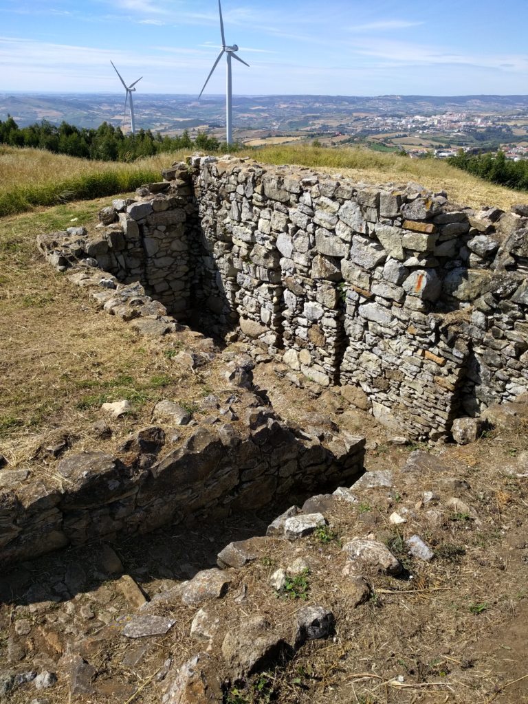
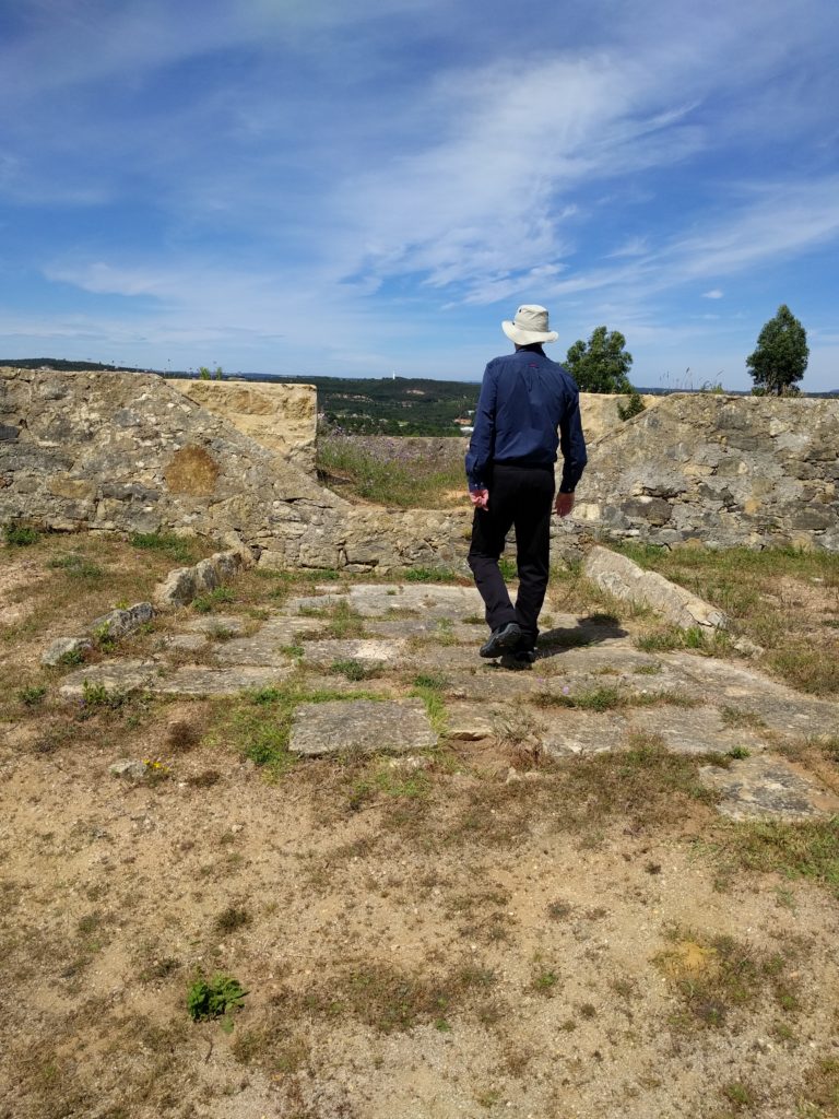
During the afternoon we visited several of the forts, and it was interesting, even for a non-engineering person like me, to see their construction. Mark pointed out the gun emplacements, showing how they slanted backwards to allow for the recoil.
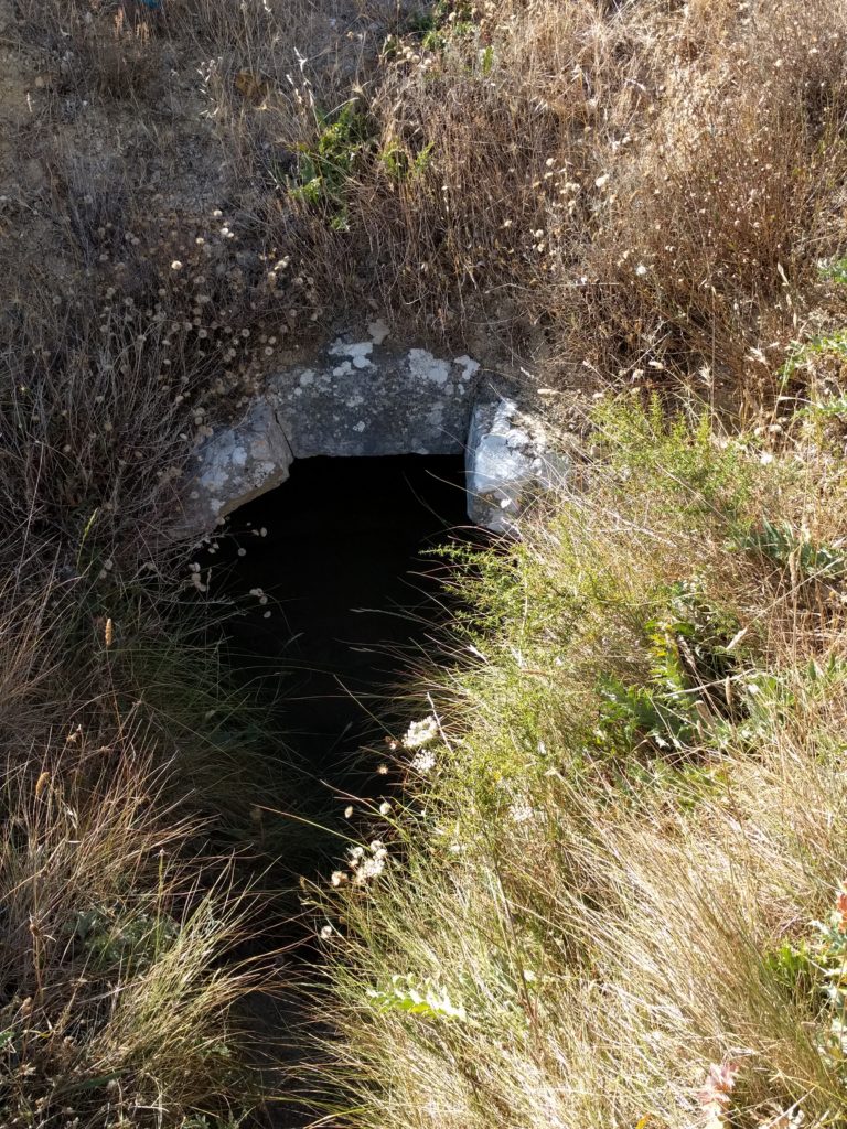
We saw where the gun powder was stored, in underground bunkers, their entrances formed into right angles so that if there was an explosion, there was some protection from the blast.
At one of the forts we saw a semaphore signalling mast (alas, I don’t have a photo of this). These were used to send coded signals across the Lines, and were so efffective that a message could be passed from one end of the Lines to the other in about seven minutes. British navy personnel and Portuguese soldiers who were proficient in the use of semaphore manned these signalling stations.
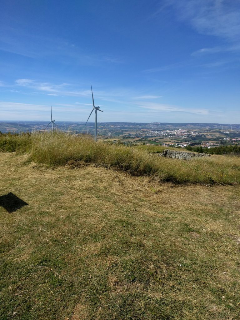
Standing at the summit of each of the forts we visited, we enjoyed amazing views over the surrounding countryside. Mark pointed out where scarping had taken place – that is, where the slopes of hills had been cut away to make them difficult to climb. Wellington had also ordered all vegetation to be destroyed so that it would not afford cover, ensuring a clear line of fire for those in the forts above. Any army trying to sneak up wouldn’t have stood a chance of escaping notice. Thankfully, although the landscape undoubtedly suffered in the past, its vegetation has now recovered.
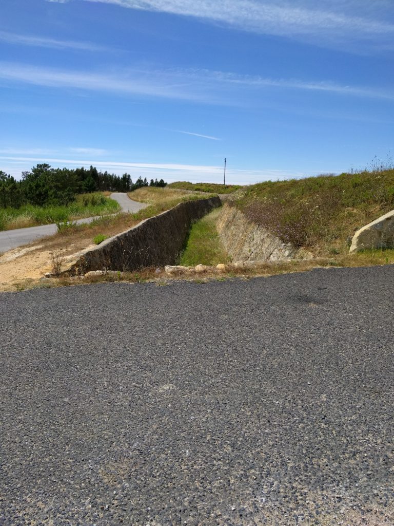
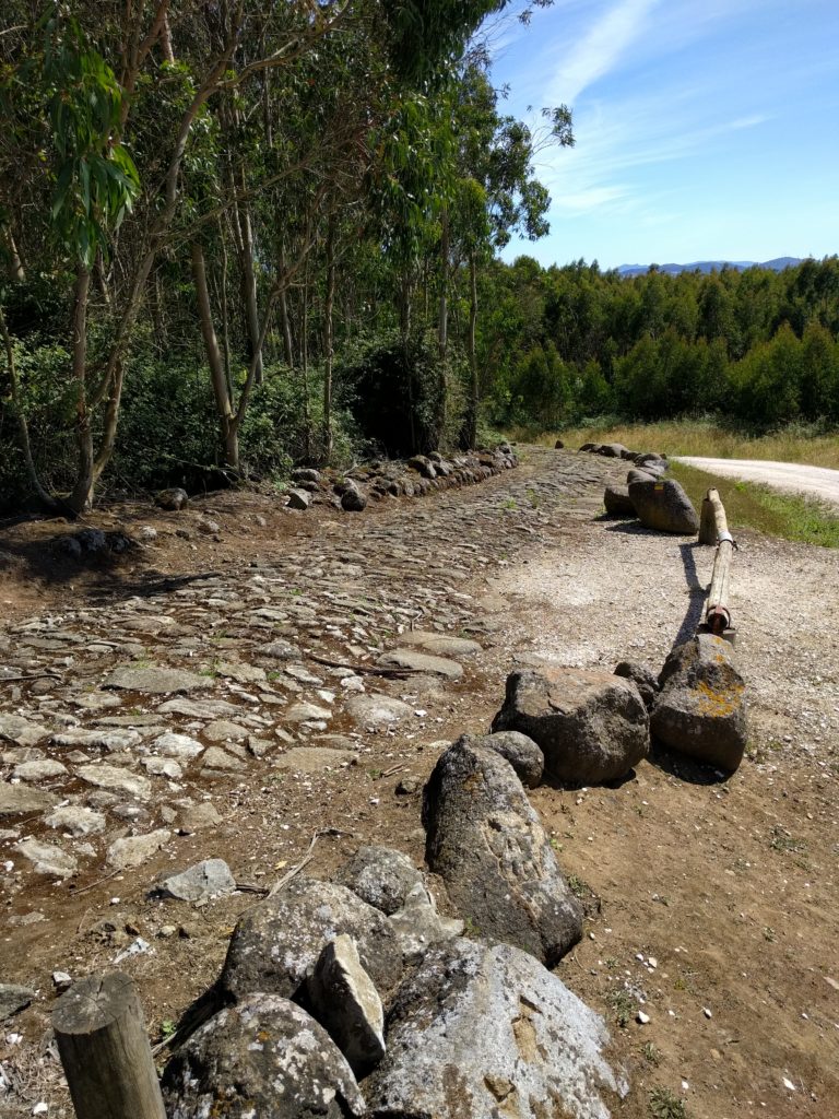
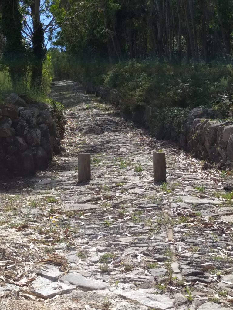
Although the intention was to make it as difficult as possible for the enemy to reach a fort, there was still the necessity to get the cannons, equipment, and men, not to mention the actual building materials, to the top of each hill where the forts were located. At the Alqueidao fort (the Great Redoubt) we saw the military road constructed for this purpose.
All too soon, it was time to return to our hotel. The day had been everything I’d hoped for. I learned so much by seeing for myself the places that I’d previously only read about, and Mark’s commentary and comprehensive notes added valuable insights to the experience.
Have you visited any historical sites in Portugal or Spain related to the Peninsular War, and would you recommend any I should put on my list?
One Response